Airport quality: LSDE 2016 project
About the project
In this project, we analyzed data collected by the OpenSky Network in September 2015. This data set consists of messages sent by the planes themselves. There are different message types that transmit either part of the current position of the plane, information about the current movement, information about the current call sign of the plane or other information. In the data, we looked for planes that fly holding or do go-arounds.
Unfortunately, the data available to us has some limitations:
- Antennas don't pick up signals from planes which fly close to the ground. That includes planes in the later stages of their approach to an airport.
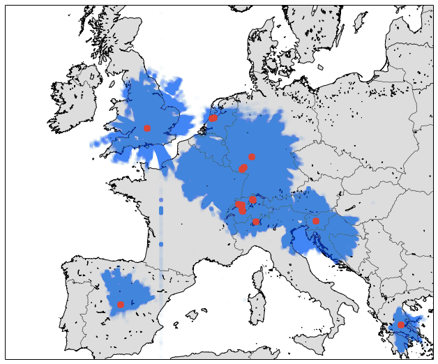
- Data coverage is limited to certain parts of Central Europe, please see the map below. There is no data when the plane is outside the blue area.
But for airports like Frankfurt Main or Amsterdam Schiphol, we have excellent data, as they are very close to antennas.
You either read or scrolled through the about page. Respect!
Here is a little gimmick for you, a 3D visualization of plane positions in one of the major London holding stacks: Bovingdon.